London’s Geology
These notes provide a general introduction to the geology of the Greater London area. This is not intended as an exhaustive account of London’s geology and structure but it attempts to summarise the geological evolution, stratigraphy and distribution of the capital’s outcrops with respect to London Geodiversity Partnership’s Geosites. Further information can be found in the numerous memoirs, books and papers listed in the Bibliography.
The Geology of the London Basin
Cretaceous: The Gault Clay Formation and the Chalk Group
Quaternary Geology: The Ice Ages
Hydrogeology: Rivers & Springs
London’s Mineral Extraction Industries
Further Reading and Information
The stratigraphic column shows the Late Cretaceous and Cenozoic succession and major events in the London Basin (R.N. Mortimore). From: Geologists’ Association Guide No. 68, The Geology of London, 2023, Fig. A3, p. 3. Reproduced with permission from the Geologists’ Association.


Cretaceous: The Gault Clay Formation and the Chalk Group
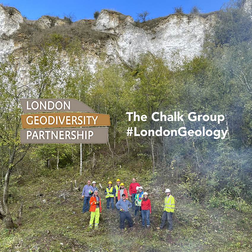
The oldest strata exposed in London are of Upper Cretaceous Chalk Group. The Chalk is exposed on the Chilterns and on the North Downs south of Croydon and in SE London. These thick layers of white, fine-grained carbonate sediments were deposited in warm seas in the Late Cretaceous.
Chalk can be seen in outcrop in a spectacular outcrop at Park Hill Pit in Carshalton. Also in South London, Chalk is well-exposed at Riddlesdown Pit near Croydon, at Chalky Dell in Abbey Woods, Dene Hole in High Elms Country Park and at Charmwood Farm in Bromley. Dry valleys in the Chalk Downs landscape can be explored at Happy Valley south of Purley. In West London, Chalk is exposed at Harefield Pit and Summerhouse Lane Pit in Hillingdon, at Pinner Chalk Mines and at Chislehurst.
South-East England had been dominated by carbonate shelf seas throughout the Mesozoic, but in the Palaeocene, the Chalk Seas disappeared and the British Isles underwent uplift initiated by the plate tectonic processes responsible for the early phases of the Alpine orogeny and became land. This uplift brought about erosion of the Chalk and initiated a 25 million-year hiatus in sedimentation.
Palaeogene Geology of London
Thanet Formation (Paleocene)
The sea returned during the later Paleocene, depositing the glauconite-bearing sands of the Thanet Formation, the base of which is marked by the Bullhead Beds (the ‘bullheads’ are fist-sized, knobbly flints eroded from the Chalk). The Thanet Formation is exposed at Gilbert’s Pit, Parish’s Pit, Bourne Wood, Cray Valley Golf Course and Spring Park and Threehalfpenny Woods. The Bullhead Bed is well-exposed in Chislehurst Caves.
The Lambeth Group (Paleocene)
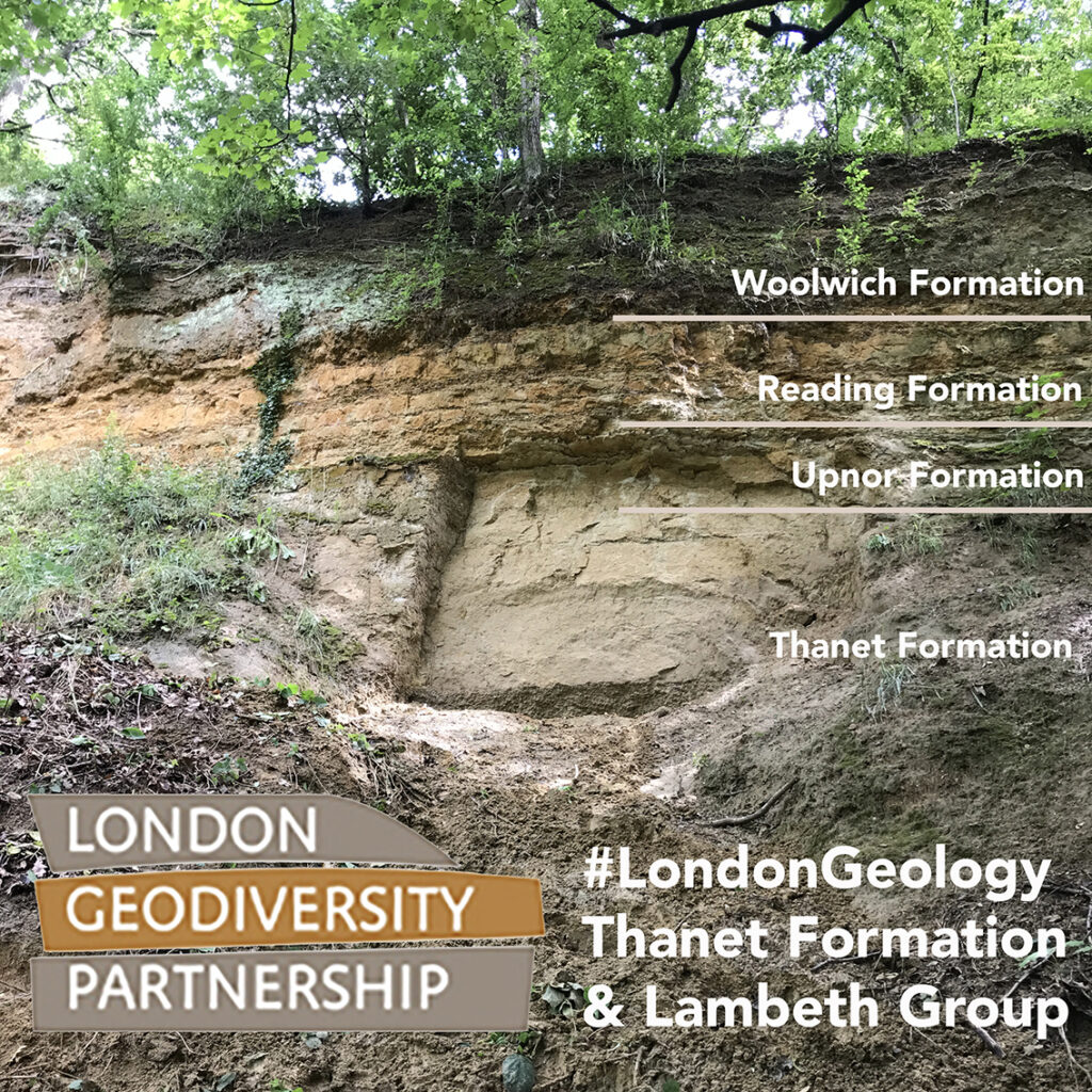
The Thanet Formation is overlain by the Lambeth Group which comprises a relatively thin and variable sequence of beds consisting of the Upnor, Reading and Woolwich Formations. The Upnor Formation is a pebbly, glauconite-rich sand. The Reading Formation passes laterally into the Woolwich Formation and therefore these units can be difficult to differentiate and are often lumped together. The Upper and Lower Mottled Clays of the Reading Formation are separated by an intervening layer of the Woolwich Formation. The silty, mottled clays are so-called because of the colour variation observed (grey, red, blue, orange, purple, black etc) which is caused by the variable oxidation states of these sediments which were deposited on an alluvial floodplain as silts and soils. The Woolwich Formation represents similar conditions, but with significant, shallow marine incursions forming lagoons. It is divided into the Lower and Upper Shelley Beds, separated by the Laminated Beds. As the name suggests, the Shelley Beds are packed with fossil oysters and other bivalves and gastropods and are well exposed in the Charlton area of South London. Gilbert’s Pit is the best exposure of the Lambeth Group in Greenwich. Here, the Lower Shelley Beds have been renamed the Charlton Member of the Woolwich Formation. Nearby is Wickham Valley Brick Works where these units were used for brick making. The Reading Formation is also exposed at Northwood Pits.
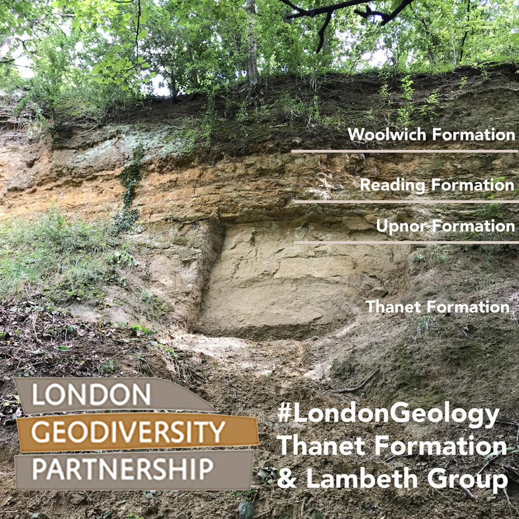

Gilbert’s Pit. Left, the stratigraphy of the Paleocene strata and right, The Lower Shelley Beds (also known as the Charlton Formation)
The Thames Group (Eocene)
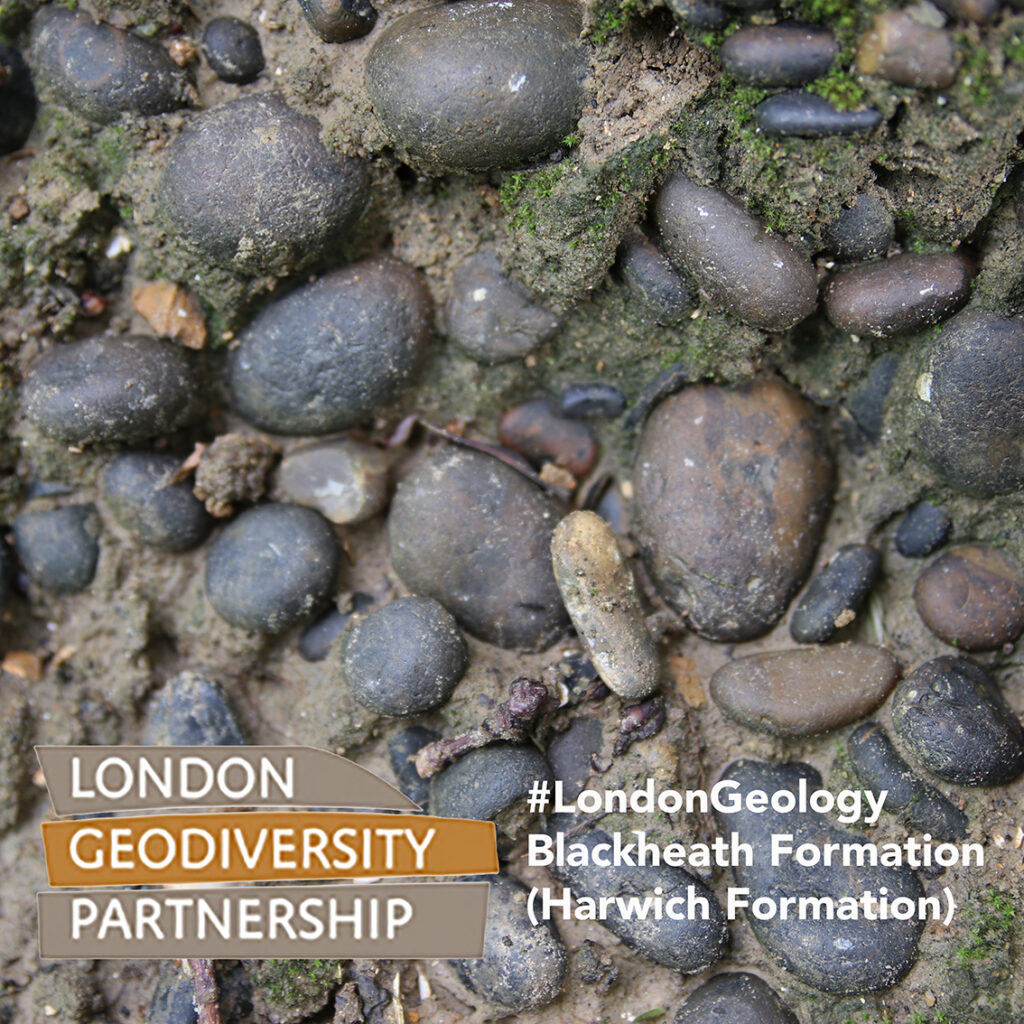
The base of the Thames Group is defined by the Harwich Formation which unconformably overlies the Lambeth Group and underlies the London Clay. It was once known as the Basement Bed (of the London Clay). This is a vary variable unit which has been divided into three members in the central London Basin; the Swanscombe, Oldhaven and Blackheath Members. The lowermost Swanscombe Member comprises glauconitic sandy clays and mainly outcrops north of the Thames in East London, where it is up to 1 m thick. it is absent in central and south London. The Oldhaven Member is found in east and north-east London and is absent elsewhere in the greater London area. It is composed of silty, galuconitic sands and abundant shell debris and dispersed flint pebbles. It is up to 4 m thick. The Blackheath Member (also called the Blackheath Beds or on occasion, Blackheath Formation) is distinctive; a conglomerate of well-rounded, black, flint pebbles. Glauconitic and shelly and clay-rich sands are also found within the succession. It is between 1-5 m thick. Blackheath Member gravels are best seen at the top of Gilbert’s Pit and Dog Rocks in Greenwich and it is also exposed in Lewisham at the Blackheath Old Gravel Pit and Eliot Pit in Lewisham, as well as at Croham Hurst, Beckenham Palace Park, Keston Common, Spring Park and Threehalfpenny Woods in South London. Sandy facies of the Harwich Formation can be observed at Elmsted Pit in Bromley. At Abbey Woods, there have been important finds of mammal fossils in the Blackheath Member in shell-rich channel deposits known as the Lessness Shell Beds.
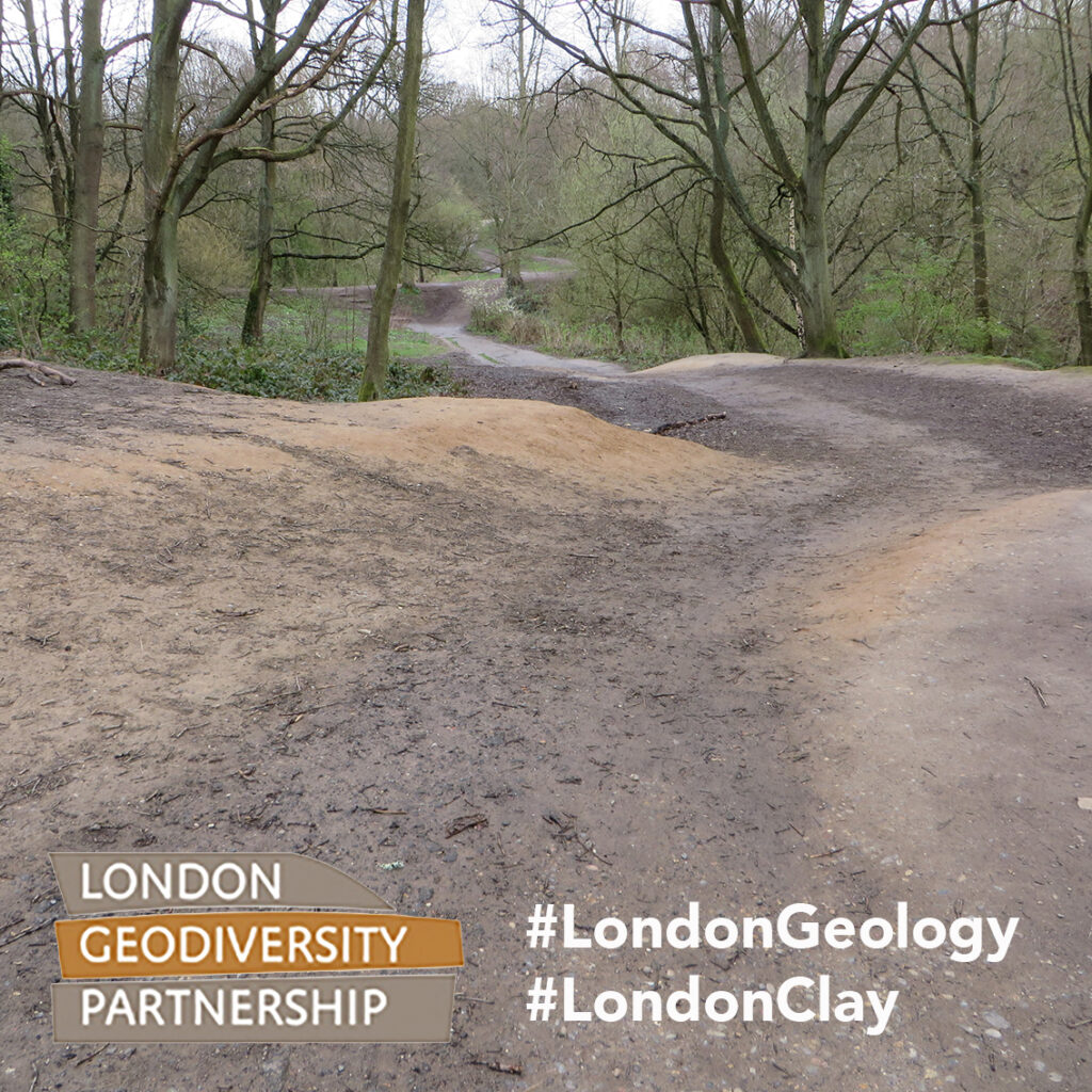
The Eocene London Clay Formation dominates much of the area of Greater London north of the River Thames and to the south-west of the capital. It is a dark-grey, slightly calcareous, marine clay, which is rich in fossils (although, unfortunately fossils are generally leached out in the oxidised layers exposed at near-surface or outcrop although they can be found on the Thames Foreshore at Isleworth). The unit varies between 90 – 130 m in thickness. The presence of the coherent London Clay has made the London underground network possible in these areas (whereas the tube tunnels do not extend to SE London, where the London Clay is absent). Despite its abundance, there are no significant London Clay sections exposed in Greater London, however Buckthorn Cutting in Lewisham does display serviceable sections through the Clay, including the occurrence of in situ septarian nodules. Temporary exposures are frequently revealed in building and engineering works. The London Clay was deposited in marine and/or tropical lagoon environments, near enough to a shoreline to allow terrestrial plant material to be washed into the sea. Plant fossils are extremely abundant, as are molluscs including nautiloids, bivalves and gastropods, fish (including shark teeth), crustaceans (crabs and lobsters) and numerous microfossils. In central London, fossil discoveries are usually associated with engineering works. A wealth of London Clay fossils were discovered whilst constructing the North Circular Road and reservoirs at Waterworks Corner in Waltham Forest. The London Clay is best observed in outcrop on Hampstead Heath and in Highgate Woods, Gunnersby Park, Wimbledon Common, on Shooters Hill and Horsenden Hill.
The Claygate Member forms the upper part of the London Clay Formation and is a silty clay. It occurs on Hampstead Heath and other high ground including Shooters Hill In Greenwich and in the High Beach area of the Epping Forest Ridge.
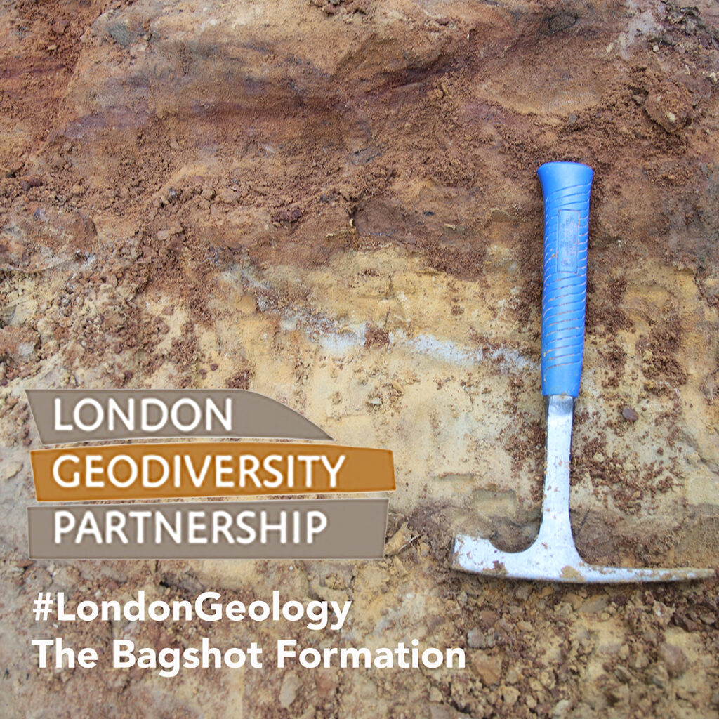
The Bagshot Formation sands cap the London Clay Formation and are exposed as outliers on the higher ground of Harrow-on-the-Hill, Hampstead Heath (where they attain a thickness of 18 m), the Epping Forest Ridge, in SW London and in Surrey on the type-area of Bagshot Heath. They are the youngest Palaeogene unit present in London. These sands have a sharp base, resting on the London Clay and locally have strings of pebbles occurring at this level (i.e. on Hampstead Heath). They are gritty, yellow-coloured, cross-bedded, ochre-rich sands which although rich in quartz, also have minerals including feldspar, white mica, tourmaline and zircon, indicating a granitic sediment source. Ochreous seams and iron-pans have developed locally and these are responsible for the formation of ponds on Sandy Heath on Hampstead Heath. The Bagshot Formation was deposited in a shallow marine to estuarine environment. These beds attain their maximum thickness on Hampstead Heath at Kenwood House Quarry and are also exposed in South London on Wimbledon Common.
A second major hiatus in deposition followed during the late Eocene to Miocene, due to the uplift of western Europe, driven by the peak collisonal phases of the Alpine orogeny. There was no preserved deposition in the London Basin for the next 48 million years.
Quaternary Geology: The Ice Ages
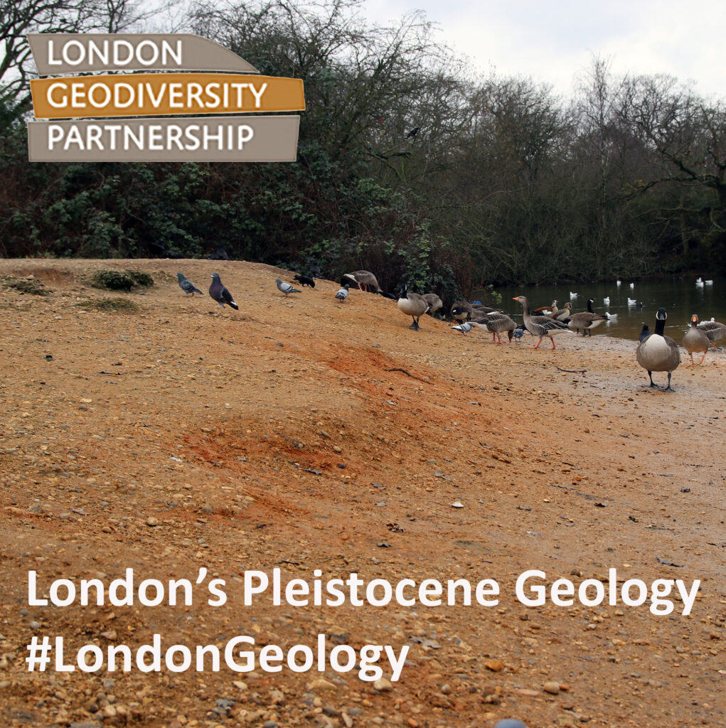
The Quaternary is divided into the Pleistocene and Holocene series. The base of the Pleistocene is placed at 2.58 Ma and the global geology of the last c. 900, 000 years (900 ka, MIS 21) has been dominated by the oscillation of global climate between ice ages and intervening warm interglacial periods. Humans first arrived in Britain during this period of relatively rapid climate fluctuations. Evidence of human habitation has been found in Happisburgh in Norfolk as early as 900 ka, and Homo heidelbergensis and Homo neanderthalensis arrived here c. 500 ka and 400 ka respectively. Anatomically modern humans (Homo sapiens) arrived c. 40 ka. This section of the Quaternary timescale is divided into a series of Marine Isotope Stages (MIS) based on the proportions of oxygen isotopes (O18 and O16) found in the calcite shells of marine fossils which directly correlate with warm or cool sea-water temperatures and by inference, oscillations between ice age climates and warmer periods. The details of events between MIS 21 and MIS 12 are obscure in the London area, as these deposits have been subsequently disrupted by later ice-sheet advances. However, it is clear that during this time, the uplifted and exposed Cretaceous and Palaeogene strata were weathered and eroded and the Clay-with-Flints layers were developed along the Chalk outcrop. Within these erosional deposits lies the Chelsfield Gravel, one of the earliest of the Quaternary gravels in the London area. These are exposed at Court Lodge Farm in Bromley and possibly represent reworked Harwich Formation sediments. Also early, but of uncertain age and origin are the Stanmore Gravels. They are pebble-rich gravels with beds of red-stained, iron-rich sand and silt. Current belief (although an evolving one) is that the Stanmore Gravels were laid down in south bank tributaries of a precursor of the present Thames, presumed to be earlier courses of the Rivers Mole-Wey, Wandle, and Darent because the gravel contains clasts of Lower Greensand Chert. Others suggest that the Stanmore Gravel may be marine in origin and of Red Crag age. Stanmore Gravels are exposed in north London around at Harrow Weald and on Monken Hadley Common.
Pre-Diversionary Thames River Terrace Deposits: Prior to the Anglian Glaciation (see below), the ancestral Thames flowed some distance north of its present location, across southern East Anglia into the North Sea. The deposits associated with this river are known as the Kesgrave Sands and Gravels, and these strata lie largely outside Greater London. However, the Gerrard’s Cross and Winterhill Gravels are considered part of this unit and are exposed in small outcrops around Springwell Farm and Watt’s Common in Hillingdon. Also of Pre-Diversionary age are the Woodford Gravel and Dollis Hill Gravel which cap the tops of hills in North London, at elevations of 50-80 m above sea-level, in their respective areas. Both contain a small per centage of chert from the Cretaceous Greensands, in addition to rounded and angular flints. These gravels can also contain seams of laminated silt. The Woodford Gravels can be seen at Knighton Wood, in Walthamstow Forest and at Chingford Hatch in NE London. Dollis Hill Gravels, overlain by Anglian Till can be seen at Trent Park in Enfield and Barn Hill in Brent. These units are poorly dated and little more can be said further than that they pre-date the Anglian Glaciation.

The Anglian Glaciation (500 – 425 ka, MIS 12) brought the ice sheets to their most southerly limit in the British Isles, with glacial tongues extending as far south as Finchley and Hornchurch in north and east London. The ice sheet left behind tills composed of silty clays with clasts of chalk, flint, Carboniferous limestone, Triassic sandstones, Jurassic limestones plus rare igneous rocks. The Chalk is the most prominent component of this unit and it is largely absent from the other Quaternary deposits. The best-known and most southerly exposure of the till (although largely inaccessible) is at Hornchurch Cutting in Havering. Evidence of till is also exposed at Trent Park in Enfield where clasts of Chalk are to be found in local ploughed fields.
The River Thames was diverted to its present path, pushed southwards, during the advance of the Anglian ice sheet from around 500 thousand years ago. From this time onwards and into the Hoxnian Interglacial period (425-390 ka, MIS 11) and later, a series of river terrace gravels were developed, stepping down like a staircase to the present course of the Thames. In this manner, the oldest terraces occupy the highest ground and get younger as we approach the modern river. Terrace gravel deposits are associated with both cold and warm climates and may contain these climatic extremes within a single deposit. They are differentiated and identified by the elevation at which they occur and by their composition, including the composition of the pebbles, the presence or absence of faunal remains (Mammalian Assemblage Zones, MAZ) or human lithic tools.

The oldest terrace unit is the Black Park Gravel (MIS 12), once exposed on Mark’s Warren in Barking and Dagenham and on Putney Heath and in Richmond Park. Slightly younger is the Boyn Hill Gravel (MIS 11), which overlies the Hornchurch Till and is well-exposed at Hollow Ponds, at Fairlop Quarry. The Finsbury Gravel, underlying Spa Green at Sadler’s Wells is similar but at a slightly lower elevation. Warm period interglacial deposits within the Boyn Hill gravel have yielded the archaic human Swanscombe Skull and numerous stone tools found at Barnfield Gravel Quarry in Swanscombe, Kent, just outside the Greater London area. MIS 10 represents a glacial period which was followed by the so-called Purfleet Interglacial (330-300 ka, MIS 9). During this period the Lynch Hill and Finsbury Gravels and Hackney Gravels were deposited. The Hackney Gravel outcrops extensively in the area around Stoke Newington, Islington and Hackney and forms the level surface of Wanstead Flats and overlies the London Clay, forming the spring line in Springfield Park. These units have yielded flint tools and the bones of bear, deer, hyaenas and other mammals and Clactonian and Acheulian lithic tools.
The next glaciation (270-220 ka, MIS 8) was succeeded by the ‘Ilfordian’ Interglacial (220-170 ka, MIS 7). Again, mammal bones are known from these deposits including the Ilford Mammoth (Mammuthus trogontherii) found in Uphall Pit as well as Levallois lithic tools. These units are associated with the extensive Taplow Gravel river terrace which is well-exposed at Sipson Lane Quarry and Osterley Park in Houndslow. MIS 6 (170-130 ka) was another glacial period. At this time and during the ensuing Ipswichian Interglacial (130-115 ka, MIS 5) humans appear to temporarily disappear from Britian. The last pre-Devensian river gravel deposit, the Kempton Park Gravel, was deposited at this time. The Kempton Park Gravel was extracted for aggregate at Bedfont Lakes in Hounslow. Interglacial sediments known as MIS 5e have yielded the bones of warm-climate mammals including hippos, rhinoceras and lions (but no evidence of humans) in Trafalgar Square. The Kempton Park Gravel is the only gravel to have yielded hippopotamos remains.
From c. 115 ka, the climate cooled once more and this most recent cold phase was the Devensian glaciation which lasted from 70 – 11 ka (MIS 4-2). In Britain, the ice sheet extended as far south as Norfolk with the glacial maximum peaking at 21 ka (MIS 2). This cold period is associated with tundra-like landscape in London, and evidence of this in the form of ice-wedge polygons are preserved as crop marks at Whalebone Lane near Romford.
The London Brickearths are fine grained, late Devensian loess deposits; wind-blown silt and clay which have accumulated in topographic depressions in layers around 3 m thick. These patches are all identical in composition, but named after the areas they outcrop, i.e. Langley, Enfield, Roding, Ilford, Dartford and Crayford Silts. Brickearths are rarely exposed these days, due to extensive quarrying for the ceramic industries and urbanisation, but a rare example is at North End Pit in Bexley. Langley Silt is exposed in Sipson Lane Quarry near Harmondsworth where it overlies Taplow Gravel.
The youngest of the gravels is the Shepperton Gravel, also of Late Devensian age (13,000-11,500 BP), which is mainly confined to the modern Thames channel and its immediate floodplain. It is overlain by Holocene sediments, known collectively as the Tilbury Formation (or Member) which comprise layers of alluvium and peat, representing smaller-scale climate and environmental changes over the last 6,000 years. Warming of the climate through the Younger Dryas and the Flandrian brings us up to the present day (MIS 1) and the archaeological periods known as the Mesolithic and Neolithic. Neolithic submerged forests at Erith, Tripcock Ness and Rainham reveal that 5,000 to 6,000 years ago London was a woodland area with alder, birch and oak trees. Hollows and scours left in the gravel deposits and London Clay became infilled with superficial deposits, including the peat-filled Rockingham Anomaly in Elephant and Castle and the Blackwall drift-filled hollow.
The Thames continues to carry sediment downstream to the North Sea, but the present-day alluvium of the river is a mixture of natural and anthropogenic components. The latter includes the rubble of the last two-thousand years of human occupation of the area and includes chalk brought onto the foreshore to create barge beds, discarded ships’ ballast from across the Globe, exotic sands imported for sand-blasting ships hulls (including garnet-rich sand imported in the second half of the 19th Century) and the debris of the WWII London Blitz as well as centuries-worth of human effluence (now conveniently whisked away by the Thames Tideway supersewer).
The Anthropocene – broadly and informally defined as the time period when human activity was the dominant factor affecting Earth’s environments and climate – has not been ratified as an official stage name by the International Commission on Stratigraphy. This is mainly because there are huge uncertainties concerning the base of this formation – its ‘Golden Spike’. Should it be placed where we first see stone tools made by Hominids in sediments or should it be placed, for example, during the Industrial Revolution of the late 18th Century or when the first nuclear bomb tests took place in the 1940s? These decisions have yet to be made however it is clear that urban areas in particular are hugely affected by the actions of humans and London is no exception.
Structure of the London Basin
The compressional, plate tectonic processes associated with the Alpine orogeny during the Neogene are largely responsible both for the formation of the broad, synclinal structure which defines the London Basin and its uplift to form dry land. This tectonic activity was also responsible for NE-SW to E-W orientated faults developed in the basin including the Greenwich–Wimbledon Fault system. Major engineering projects have taught us much about the structural geology of London and particularly the location of faults, many of which have been discovered for the first time through these works. Most of London’s faults are relatively small with throws of less than 2 m.


Various high points in London afford spectacular views of the London Basin. In Central London, the London Eye, the Monument to the Great Fire of London and the London Cable Car all offer excellent views along the central London Thames Basin. In outer London, various high points including Hainault Forest, Pole Hill in Chingford (with a view directly along the Prime Meridian to Greenwich), Alexandra Palace Terrace, Primrose Hill, Greenwich Park, Shooters Hill and Abbey Woods.
Hydrogeology: Rivers & Springs

The Chalk is the main aquifer of the London Basin, recharged by rainfall on the Chilterns and North Downs. From this higher ground, groundwaters flow downslope towards the centre of the London Basin and is or was discharged at artesian springs, prior to later water management projects. An artesian pump, extracting water from the Chalk aquifer still stands in Tooting. In Carshalton Park, springs in the Chalk that were the source of the River Wandle were engineered to form water features, however modern pumping of the groundwaters means tjat they only hold water in exceptional years. The Quaternary gravels and Bagshot and Harwich Formations are also aquifers, albeit minor, nevertheless, these units are also important in the development of London’s springs. Springs are common features of London’s historical and contemporary hydrogeology and the presence of springs is often to be found in place names such as Sadler’s Wells, Clerkenwell, Woodford Wells and Springfield Park in the Lea Valley. On Hampstead Heath, springs emerge at the boundaries of the Bagshot Sand and underlying Claygate Beds, which are the sources of the Fleet and Westbourne Rivers, while the boundary between the Claygate Beds and London Clay, provides the source of the ‘sweet’ water of the River Tyburn. Hampstead was known for its iron-rich ‘chalybeate’ waters as is St Blaise’s Well in Bromley. At Greenwich Park, springs located at the junction of the Lambeth Group and Harwich Formation fed a conduit which supplied the Royal Naval Colleges and Greenwich Palace. The Ladywell Spring in Lewisham is also sourced from the Lambeth Group.
Bringing adequate water supplies to the growing city of London was a major requirement for London’s population. The artificial New River, constructed in the early 17th Century, brought water into the capital from springs near Ware in Hertfordshire. Originally this canal terminated in Clerkenwell, having filled a reservoir at Claremont Square in Islington, but in 1946 the New River was terminated in Stoke Newington and now feeds the reservoirs at Woodberry Wetlands. The New River has been diverted from the East Reservoir to Coppermills in the Lea Valley where it is processed to supply water to Canary Wharf. Claremont Square reservoir on the Pentonville Road has now been covered over. From the 19th Century, open reservoirs were constructed in the Lea and Colne Valleys. In addition, there are around 50 underground reservoirs in London. The largest underground reservoir in Europe is on the River Peck at Honor Oak (Beechcroft Reservoir) in South London, sunk into the London Clay and opened in 1909. Much of London’s water is now supplied by the Thames Water Ring Main, completed in 1993, fed by gravity from reservoirs in the Colne Vallley of west London.
London’s Mineral Extraction Industries
Limestone, sand and clay from the London Basin have been extracted over the last two millennia for numerous industrial processes.
Chalk mines have been in operation since the Roman period with the soft limestone used for lime-making subsequently used both for building and agricultural purposes. Chalk mines are preserved at Pinner and at Chislehurst Caves and numerous opencast chalk pits were in operation in south and south-east London in the 19th Centuries. One of the largest and still accessible examples is Riddlesdown Pit. A lime kiln is preserved in Burgess Park near Walworth away from any local chalk sources. Chalk to feed this kiln was probably brought from Kent along the Grand Surrey Canal.
The extraction of glass making quartz sands from the Thanet Formation was an industry in the Charlton area of Greenwich. These quartz-sands were quarried from Gilbert’s Pit and the nearby Charlton pit which now contains the Charlton Athletic Football Stadium. Charlton sand was used for making green beer bottles and the finest sands were also used for metal casting at the Woolwich Arsenal. Bagshot Sands on Hampstead Heath were quarried for the construction of the nearby railway, heading into St Pancras Station and during the WWII, they were used for filling sandbags.
Brick and tile making has been an important London industry since the Roman period, with bricks being made both from the Eocene Claygate Member and the Holocene Brickearths. A Roman kiln has been excavated in Highgate Woods where again, the Claygate Member was used for brickmaking. The classic London Stock Brick was made from Holocene Brickearth clays, mainly from the Langley Silt, but the Brickearths were used for brick-making wherever they outcropped. In the central area, extensive pockets of Langley Silt Brickearth occur in Islington, Marylebone, The City of London and docklands area. Much of this will have been worked out and built over and these deposits were once probably far more extensive than marked on the recent geological maps of these areas. Examination of 17th and 18th Century topographic maps shows a great many brick pits located throughout these parts of the capital. Bricks would have been quarried, moulded, and fired on site and used for buildings nearby until the Brickearth was locally exhausted. The bottle-shaped brick kiln on Walmer Road in Notting Hill is a survivor from 18th Century. Ceramic industries here used Langley Silt Brickearths for bricks and tiles. However, by the later 18th and 19th Century, the centre of London brickmaking was around Cowley, Yiewsley and West Drayton in Hillingdon (formerly Middlesex), once again exploiting the Langley Silts. Vast brickworks were in operation in this area, located along the Grand Junction Canal until the industry went into decline in the early 20th Century. The brick pits at Erith Park used the Crayford Silt for brick and tile making into the 20th Century. Evidence of local brick and tile works is often found in 19th Century garden walls built from brick clinker, waste material from the brick clamp kilns. Such walls can be seen in many areas of London including in Upper Walthamstow and at the Grange Brick and Tile Works in Willesden Green. These brickfields as well as those on Hampstead Heath and in Caledonian Park in Islington made dark red-brown bricks and tiles from the London Clay and Claygate Member. The Bagshot Sands on Hampstead Heath were also mixed with London Clay as temper.
Copperas production is one of England’s forgotten industries, but the production of copperas, iron sulphate hydrate (also known as green vitriol), was an essential ingredient for making black writing ink up until the 20th Century, a material that was required in gallons in the City of London. The other component for black ink is a tannin-based dye extracted from oak galls or similar materials. On its own, this dye is an insipid brown colour, but it turns jet black with the addition of copperas. Copperas also found use as an architectural render from the 18th Century onwards. Copperas is made from iron pyrites which was collected from beaches along the Thames and the Thames Estuary where it had weathered out of the London Clay. The ore was crushed and left to oxidise in rainwater for months or years until it formed iron sulphate. Copperas works were in operation along the Thames from Thames Ditton near Esher to a concentration of works in Deptford (there is still a Copperas Street in Deptford), all of which were active since at least the 17th Century. In the 19th Century the industry moved to Walton-on-the-Naze in Essex where fields were flooded to ‘brew’ the copperas.
Sand and gravel extraction for aggregate is an ongoing industry in several places in London, although some pits, such as at Mark’s Warren have recently closed. Bourne Wood in the Thanet formation sands is still in existence but is likely to be wound up in the near future. Sipsons Lane Quarry in the Taplow Gravel at Harmondsworth is one of the last remaining aggregate quarries in the Colne Valley.
‘Geological Illustrations’ in London
Not all the geological ‘outcrops’ in London are the real thing! This is especially the case when visiting the capital’s parks and gardens. In the 19th Century particularly, rock gardens and stumperies were fashionable, and this taste extended to the installation of imported rocks and fake outcrops. Some of these were professionally constructed and were described as rockworks or geological illustrations.
The oldest and most spectacular ‘geological illustrations’ are at Crystal Palace Park where a geological theme park was created in the mid 19th Century featuring models of prehistoric creatures and reconstructions of outcrops, to illustrate the geology of the British Isles. Other small-scale illustrations include a reconstruction of the Portland and Lower Purbeck Groups and a grove of fossil tree trunks in Regent’s Park. The tradition of geological illustrations to illustrate the concepts of geology also still continues in London. The Natural History Museum’s Evolution Garden was opened in 2024 and it is designed to illustrate both the geology of the British Isles and the evolution of life on Earth.
If you could not get the real thing, there was a man who was prepared to construct outcrops for you. Elaborate artificial ‘rockworks’ were constructed by the Broxbourne-based firm of James Pulham & Son, and some of these are convincing enough to make geologists look twice. Pulhamite rockworks are a feature of a number of London’s parks and gardens including at Battersea Park, Bromley Park, Sundridge Park Manor and at Knighton Wood. Rockwork still finds a place in London’s environment today. Rock-climbers’ bouldering parks have been constructed at Fairlop Waters Country Park in Redbridge and huge boulders of Cornish granite have also been installed, for the use of climbers, in Shoreditch Park and on Mabley Green in Hackney.

A pdf version of this text can be downloaded here.
Please cite this information as follows: London Geodiversity Partnership, 2026, The Geology of the London Basin, https://londongeopartnership.org.uk/londons-geology/ (insert date accessed).
Further Reading and Information
Bibliography of London’s Geology
BGS Geological Maps and Memoirs of London are available to view via the BGS website or on our Links page.
A gallery of images illustrating the geology of London can be viewed here.
A useful summary of London’s geology is published in London’s Foundations (2012).